
If that's the case, it's a bit of an ugly hack but you could make a wrapper script placed in /usr/local/bin/inkscape like this:
#!/bin/bash

flatpack run org.inkscape.Inkscape ${*}
(the ${*} will pass along all the arguments that the wrapper script was called with)
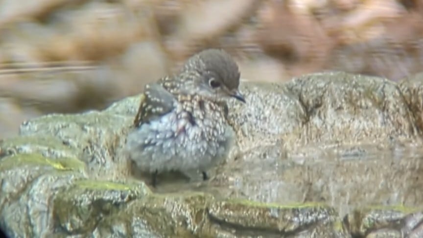
Juvenile Bluebird (Eastern Tennessee)
Excuse the slightly blurry shot from holding my phone up to my spotting scope
I use 101domain.com
They're not always the cheapest option but they seem to support a lot of TLDs and their customer support is always fast and staffed by actual humans.
Ah interesting - that makes sense. I didn't think to treat it like an image mask like that. Thanks!
Thanks! I've made lots of wide area and close-up terrain models using DEM and lidar before, but trimming to state boundaries has always been the challenge. Every time I try to trim the raster data in qgis I don't get anywhere, even though it should be possible.
The OpenSCAD primitive is a new one for me though - thanks! In the past I've just used the DEMto3D plugin in qgis.
Terrain STL files of individual US states?
Does anyone know of a good resource to download or generate terrain / elevation STL models that are bound to the shape of US states?
I came across this posting but the files are pretty low resolution and look pretty bad at the size I want to print.
For me, they'd have to
- Replace /u/spez
- Implement some sort of publicly auditable accountability re: shadowbans and database-level comment editing
- Open-source significant parts of their platform.
I have zero expectation that any of these things will happen. The most healthy way forward, for an open and free internet, is the meritocracy of the fediverse.
The face of my silly little grey monster
The best part about cats is the face they make when you make a funny sound.