
You're viewing a single thread.
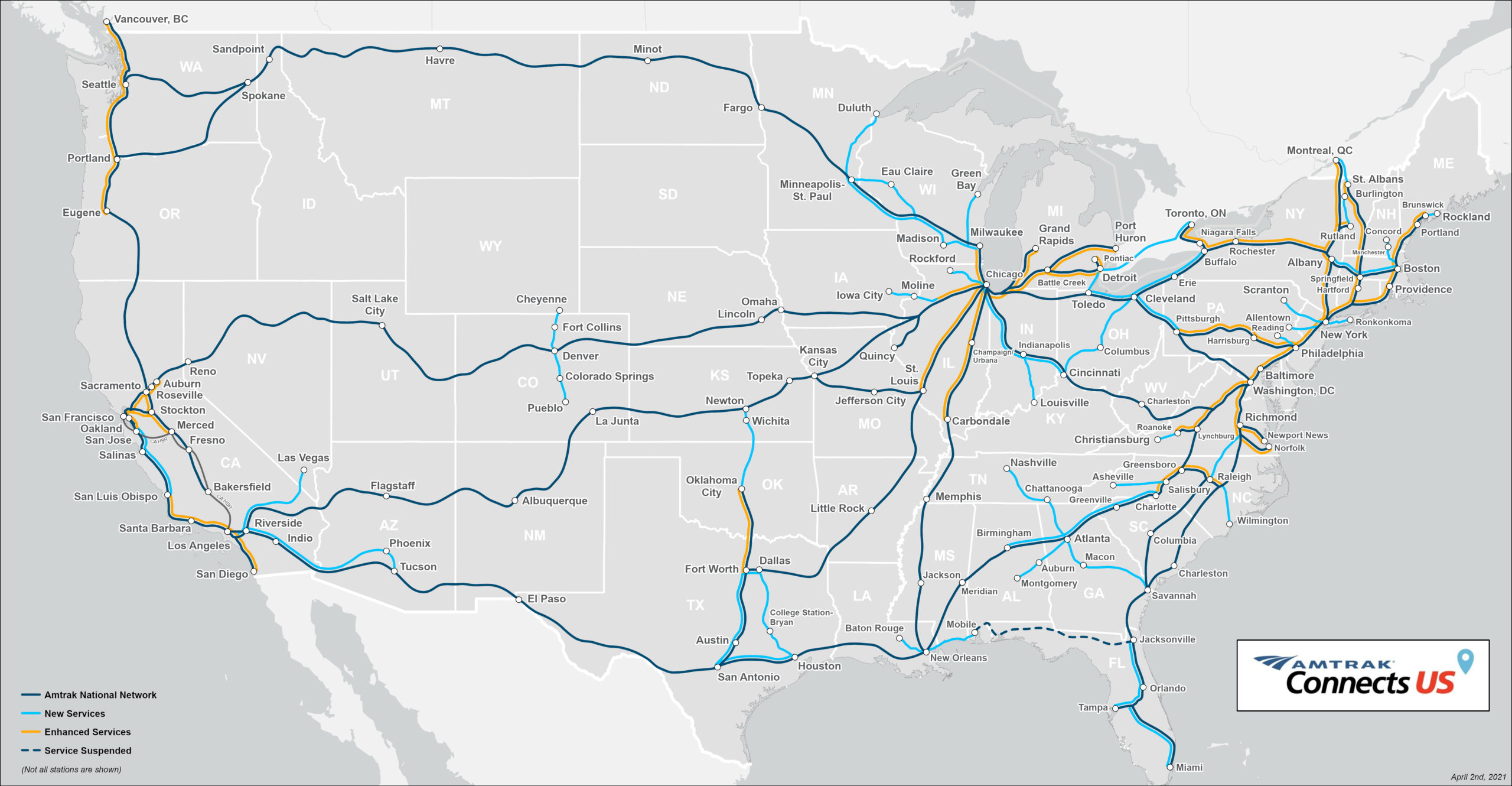
Without an "after" pic showing the map as it is now, this isn't informative for most people
I'll edit and put it in the body too. Good call.
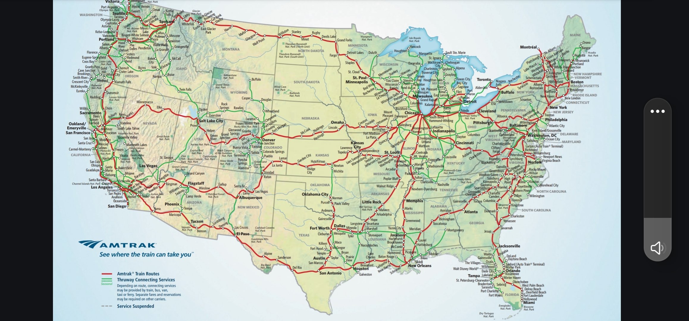
This map doesn't show all the stations.
Here is the actual current map
From
Important to note the key in the bottom left. The green lines aren't trains, they're generally bus routes that Amtrak coordinates with.
Blame Amtrak. I got the image from their website.
That map is on the Amtrak website in an article highlighting areas of planned new development. https://media.amtrak.com/amtrak-connects-us/
Ah, my mistake. Thanks.
The European mind cannot comprehend this simple trick!
Nice, Nova Scotia exists after 1979.
So the grid is basically the same but most of the stations are gone.
I'm not sure why the current map doesn't show them, but no, the stations are not gone. I ride the Amtrak from Chicago far out west quite often, it still stops in all of the places that the old map says.
The “after” pic isn’t showing all the stations.
The other difference is some routes get 2 trains a day and it probably cost $5k to go cross country
2 trains a day would be an improvement for many routes, a lot are 1 train a day or 3 trains a week.
Yeah i didnt mean to make antrak sound good. Its a laughable grid even for 1979 and to not have evolved since then while lowering frequency and increasing fares its just a joke.